
In 1884 Gladstone's Liberal government, with a large majority in the House of Commons, introduced a Representation of the People Bill to extend the franchise within existing constituency boundaries. It was opposed by the Conservatives in the House of Lords. It took the intervention of Queen Victoria to get the two sides to negotiate a settlement. The Lords Tories agreed to the electoral reforms on condition of a revision of constituency boundaries. The Redistribution of Seats Act 1885, given the Royal Assent on 25 June 1885, was the result. |
The former two-member seat of New Shoreham and the single-member seats of Chichester, Horsham, Lewes, Midhurst and Rye were abolished. The county was divided into two divisions, East and West, with three single-member constituencies in each. |
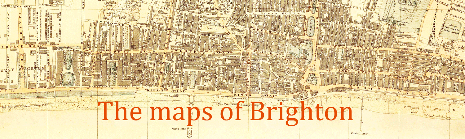
The map is signed by Lt-Colonel (later Major-General) Robert Owen Jones (1837-1926), one of the two army cartographers on the Boundary Commission along with four government officials, two from each party.
To enlarge, click on the map (opens in new window).
Return to previous page
Maps index
Go to streets
A B C D E F G H I J K L M N O P Q R S T U V W X Y Z
Page created 26 July 2021