
Streets beginning with
A B C D E F G H I J K L M N O P Q R S T U V W X Y Z

You are here: Home > Places > Streets > Streets H
Streets beginning with A B C D E F G H I J K L M N O P Q R S T U V W X Y Z | Search the site |
| H | Census districts lists Click on any image to open it in a new window |
references |
| Haddington Close, Hove BN3 3 |
Provides rear access to some properties on the west side of George Street. | |
| Haddington Street, Hove BN3 3 |
1a was the Blatchington Road Assembly Rooms (Blatchington Hall) and a rifle range before becoming the Empire Picture Theatre in December 19101. The cinema closed in 1932 and the building was used for commercial and engineering purposes. It was replaced by a supermarket (now a Cooperative Food store). | Pa1875— 1brightonfilm.com |
| Hadlow Close BN2 0 |
Post-war council development, developed c1956, named after Sussex village (Hadlow Down). | Ke1956— |
| Haig Avenue, Coldean BN1 9 |
Named after the First World War military commander, Field Marshal Douglas Haig, 1st Earl Haig (1861-1928) (cf, the adjacent Beatty Avenue) | Ke1954— |
| Hailsham Avenue, Saltdean BN2 8 |
Numbered 1 September 19551. | Ke1947— 1ESRO DB/D/27/326 |
| Halland Road, East Moulescoomb BN2 4 |
Built in the late 1940s as part of the expansion of expansion of council housing. Most streets in the north of the area are named after Sussex villages. 1  2 2 1. Halland Road at the junction with Moulsecoomb Way soon after construction; 2. At the junction with Southgate Road. |
Ke1947— |
| Hallett Road BN2 9 |
William Hallett founded Kemp Town Brewery and built St John the Baptist RC Church in Bristol Road. He became High Constable of Brighton in 1834 and was the second mayor of Brighton in 1855; he lived at Manor House in nearby Manor Road. His son (?) William Henry Hallett served as mayor from 1866 to 1868 and again in 1881. | Pi1925— |
| Hallyburton Road, Aldrington BN3 7 |
Part of the Stretton Estate to the north of the original Aldrington estate. Hallyburton Tom Stretton (1878-1978) was the second son of the land-owner, Joseph Harris Stretton. No properties listed before 1923. | Pi1909— |
| Hamilton Close, Portslade BN41 2 |
Cul-de-sac. | |
| Hamilton Road, Prestonville BN1 5 |
Built by Daniel Friend in the 1860s early in the Prestonville development. Renumbered 6 September 19061. 32 was the birthplace of Eric Gill. Plaque. ph 64, Prestonville Arms was opened c1867 by Kemp Town Brewery and is allegedly haunted. Highlands 1881. |
Pa1868— 1ESRO DB/D/27/129 |
| ∫ Hamilton Terrace, Preston | Built by Daniel Friend in the 1860s early in the Prestonville development. Incorporated into Old Shoreham Road 30 August 19381 and renumbered as 2-12. | Pa1869 1ESRO DB/D/27/47 |
| Hampden Place | See Hampton Place. | |
| Hampden Road BN2 9 |
Built piecemeal from 1856 to 1873 and identified as Hampton Road in directories in the 1860s. ph 12, Hampden Arms opened in 1891 and was refurbished by Stavers Tiltman for Portsmouth & Brighton United Breweries in 1938. It closed by 1970 and was converted for residential use beyond recognition. |
Fo1856— |
| Hampstead Road BN1 5 |
Under construction 1893 (eight named houses). Numbered 6 July 19051. ph 1, Station Hotel, formerly the Tivoli Hotel, was designed by Charles Henry Buckman for Tamplin's Brewery in 18912, although the date on the pediment is 1894. It is on the B&H local list. 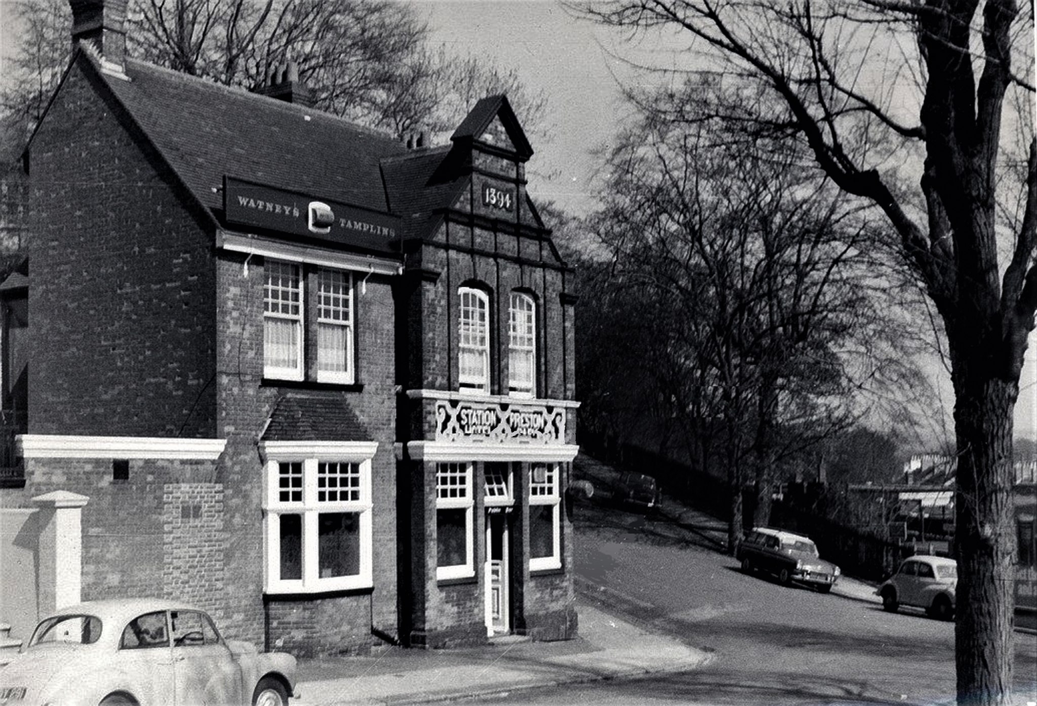 The Station Hotel, Hampstead Road. |
Pa1893— 1ESRO DB/D/27/132 2ESRO DB/D/7/2754 dated 1891-07-02 |
| Hampton Place BN1 3 CA: Clifton Hill (6-34 even, 11-39 odd). |
Named after Hampton Villa, a Grecian-style house that stood nearby1. Built c1825; also known as Hampden Place. Renumbered 3 December 19032. 1 is called Codrington House after Admiral Sir Edward Codrington. 11, 13, 15, 19, 21, 25, 29-37 are Grade II listed. 8-28, 32 and 34 are Grade II listed. 14 freehold sold for £700 in April 1904; it was let for £50 a year3. 39 Hampton House is Grade II listed. |
Br1845— 1Sue Berry: 'Thomas Kemp and the Shaping of Regency Brighton c181-1845' in Georgian Group Journal, xvii, 2009: 128 2ESRO DB/D/27/122 3The Builder, 14 May 1904:533 |
| ∫ Hampton Road | See Hampden Road. | |
| Hampton Street BN1 3 |
A commercial street; 3-5 were set along a turn-in on the north side. The south side is now part of Mitre House (see 144-145 Western Road), built in 1935, originally red brick but rendered and painted off-white in 2012. 1-5 were stables in the 1940s, all occupied by fly proprietors in 1858. 5 freehold sold for £700 in April 1904; it was let for £50 a year1. 1  2 2 3 3 1. Hampton Street from Spring Street [Brighton & Hove Museums]; 2. A similar angle later; 3. Further west, looking past the former fly garages towards Hampton Place 4  4. Looking eastwards. |
Br1845— 1The Builder, 14 May 1904:533 |
| Hampton Terrace BN1 3 |
Continuation of Upper North Street, built in the mid 1840s, absorbed as 58-62 Upper North Street. 1 was the residence of Alderman George Cobb Jr. Grade II listed. 2 is Grade II listed. |
Fo1850— |
| ∫ Hampton's Lane, Withdean | A former name of Withdean Drove1, later Peacock Lane. | 1ESRO DB/D/27/129 |
| Hamsey Close, Whitehawk BN2 5 |
Cul-de-sac. Numbering 11 June 19801 | 1ESRO DB/D/27/445 |
| HANGLETON | 'Farmstead by a sloping wood (hanger tun)'. Identified in Domesday Book as Hangetone1, with a population of more than 200, which the Black Death reduced to two by 1428. The tenants of Hangleton Farm from the late 17th century until 1914 were the Hardwick family. The name is spelt Angleton in the 1820 Poll Book. The parish of Hangleton was united with Portslade on 28 July 1864. The whole 1,120 acres of the parish remained farmland until development began shortly before the Second World War, spreading from Aldrington. Map shows the extent of Hangleton adjacent to the Dyke railway branch line in the OS 1896 survey. |
1See Clayton, Charles E: 'Hangleton and its history' in Sussex Archaeological Collections, vol 34 (Lewes: H Wolff, 1886) |
| Hangleton CA | Conservation area, designated in 1984, comprising 6.29ha (15.54 acres), comprising mainly Hangleton Manor, St Helen's Church and St Helen's Park. | Character statement Map |
| Hangleton Close, Hangleton BN3 8 |
T-shaped cul-de-sac, mainly bungalows. | Ke1947— |
| Hangleton Gardens, Hove BN3 8 |
Ke1947— | |
| Hangleton Lane, Hove BN3 8 CA: Benfield Barn (Benfield Barn and barn complex, Benfield Cottages. CA: Hangleton (28-44 even). |
Benfield Barn probably dates from the 18th century. It was part of the Benfield Manorhouse farm, which was built in the early 17th century but demolished in 1871 to make way for a row of cottages. Benfield Cottages (4) and Ivy Cottages (2) were on ths south side south, near St Helen's Drive.1 |
1Ke1958— |
| Hangleton Lane, Portslade BN41 2 |
1-6 Vallensdean Cottages were built 1825. | Ke1947— |
| Hangleton Link Road, Portslade | ||
| Hangleton Manor Close, Hangleton BN3 8 |
Cul-de-sac of executive housing in the former grounds of Hangleton Manor. | Ke1958— |
| ∫ Hangleton Road, Preston | Former name of Tivoli Road until at least the early 1930s. The name also applied to the northward continuation, later Withdean Road. The house then on the corner of Withdean Road and what was later renamed Withdean Avenue was called Hangleton Lodge (Treacher map 1898). Built c1900. Numbered 23 May 19291; 39 houses2. | To1899 1ESRO DB/D/27/142 (includes later pencilled additions and notes) 2Ke1958— |
| Hangleton Road, West Blatchington BN3 7 |
Developed c1910. Land for widening the road was given to Hove Corporation by the Nevill family on 8 April 19361. ph Grenadier Hotel was designed by John Leopold Denman and opened in 1935. 132, Shanklin Court is a freehold block of 28 flats and six garages on 999-year leases from 1 January 2021. See also Shanklin Road, where there is another Shanklin Court. |
Pi1910— 1ESRO ABE/1N |
| Hangleton Valley Drive, Hove BN3 8 |
Plans for the new road were submitted to Hove Borough Council by T Braybon & Son (Estates) Ltd in December 19554. Development started late 1950s. Hangleton Manor, now the oldest surviving domestic building in the city, was built in the 1540s for Richard Bellingham; his initials are carved above a fireplace. The front wall incorporates carved stones from Lewes Priory, which was demolished in 1537. It was altered about 150 years later for farm use, which continued until before the Second World War (when it was used by the army). It was abandoned between 1964 and 1969, falling into disrepair but restored again in the 1970s as a public house/restaurant and dwelling, owned by the Dorset brewery firm of Hall & Woodhouse. Grade II* listed1 with the adjacent Old Manor House, the west wing of the manor, was built in the 15th century. From 1786 it was occupied by William Hardwick and his descendants. The Dovecote south of the manor grounds dates from the 17th century. It was restored 1983-87 and is Grade II listed2. The Cottage and Rookery Cottage were the 16th-century gatehouse to Hangleton Manor, converted to five cottages after 1800 and then into two cottages in the late 20th century. They are Grade II listed3. 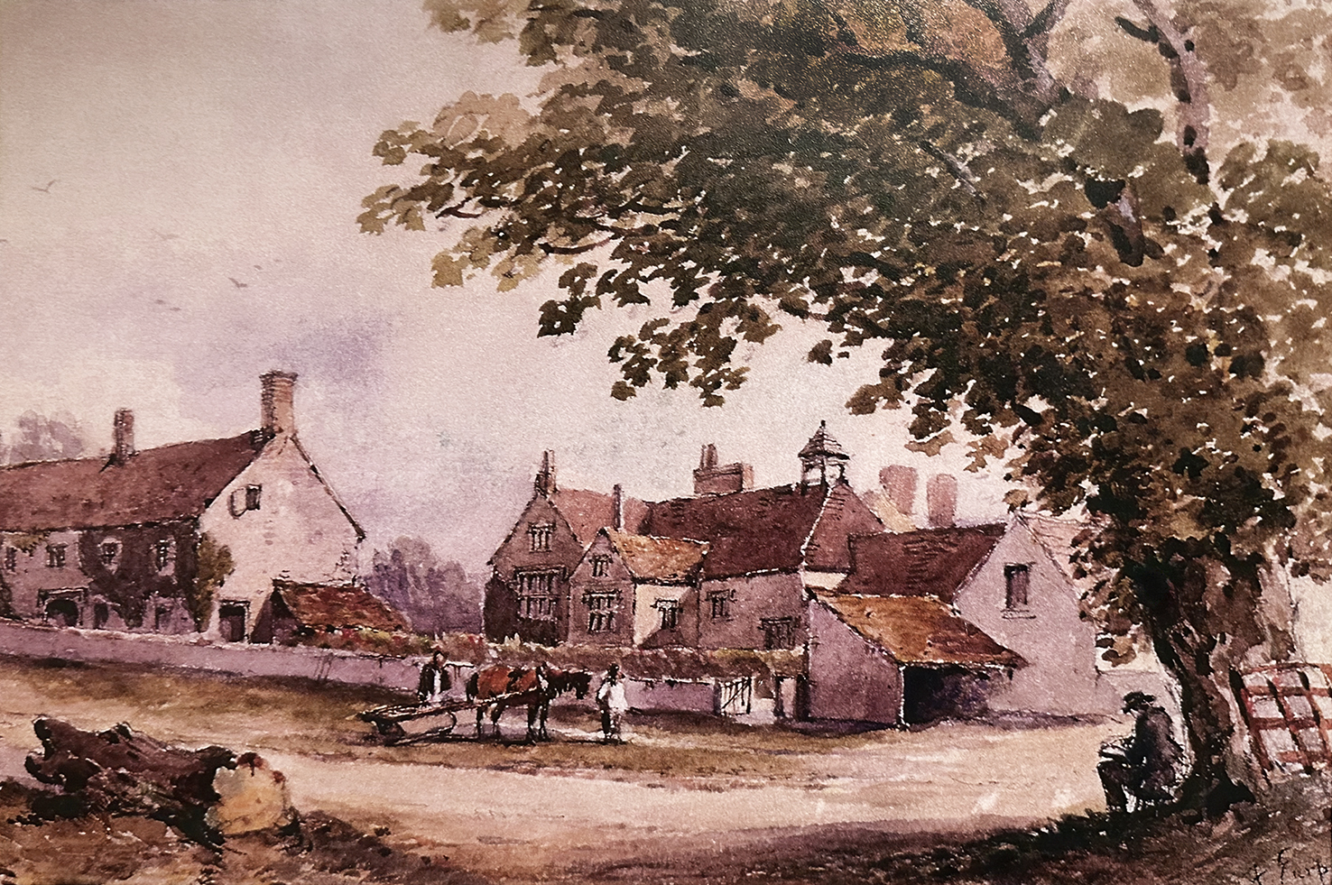
Frederick Earp: Hangleton Manor c1850 [Brighton & Hove Museums]. |
Ke1958— 1HE 1187557 2HE 1298635 3HE 1187558 4ESRO DO/C/6/17474 |
| Hangleton Way, Hangleton BN3 8 CA: Hangleton (St Helen's Church, St Helen's Park). |
Post-war development. St Helen's Church is the oldest in the city, probably dating from the 12th century with a 13th-century tower and medieval decorations.. Between 1864 and 1951 the parish was merged with Portslade, the two having been held together from time to time since 1523, then returned to its former status as a parish in its own right. The churchyard includes the graves of Samuel Augustus Barnett and his wife Dame Henrietta Barnett. Barrister and MP Edward Vaughan Hyde Kenealy is also interred here. The church was Grade II* listed in 19501.  Scenes for the 1909 film The Boy and the Convict, directed by Dave Aylott for Williamson Kinematograph Company, were filmed in the north-west corner of the graveyard. Scenes for the 1909 film The Boy and the Convict, directed by Dave Aylott for Williamson Kinematograph Company, were filmed in the north-west corner of the graveyard.†ph The Downsman was opened by Tamplin in 1956 and closed in 2014. It was demolished and, with the adjacent greenfield site was replaced in 2019-2021 by a four-storey apartment block and two terraces of two-storey houses. Pre-historic flints and a number of medieval features were found here during preparations for redevelopment. 248. Early iron age pottery was found here.  St Helen's Churchyard in Williamson's The Convict and the Boy (1909). |
Ke1947— 1HE 1298636 |
| † Hanningtons Cottages | Probably off Brighton Place. Dwelling houses for unmarried male employees of Hannington's store in North Street. There were 36 residents in 1891, identified in the census by departmental role. |
Census1891 |
| Hanningtons Lane BN1 1 |
Shopping/residential lane behind North Street, designed by architects Morgan Carn and completed 2019. | |
| HANOVER | The UK ruling house 1714-1901. The council ward was designated in 1894. | |
| Hanover Crescent BN2 9 CA: Valley Gardens. |
Built c.1822 by A H Wilds for Henry Brooker. Brighton Corporation acquired the gardens by compulsory purchase in 1884 under the Brighton Improvement Act. All 24 houses, the North Lodge, South Lodge, garden wall and the gate piers on Lewes Road are Grade II listed.1 as are the garden wall and gate piers2. North Lodge has a tile-and-iron-frame street name. 10 was the residence of novelist Horace Smith between 1826 and 1840. 11 was the residence from 1844 to 1846 of Sir Rowland Hill. Plaque. North Lodge is by Amon Henry Wilds for Henry Booker, c1822. Grade II listed3. South Lodge. is by Amon Henry Wilds for Henry Booker, c1822. Grade II listed4.  Hanover Crescent looking south. |
PO1845— 1HE 1381607 2HE 1381608 3HE 1381609 4HE 1381610 |
| Hanover Mews BN2 9 CA: Valley Gardens. |
Private road behind Hanover Crescent. | |
| Hanover Place BN2 9 CA: Valley Gardens. |
Percy Alms Houses see Lewes Road. | Fo1848— |
| Hanover Street BN2 9 CA: Valley Gardens. |
Built from 1822, as shown by the date on no 1. Renumbered 27 September 19341 consecutively along the south-east side from Southover Street then back along the north-west side. [ph] 22 was The Little Fox from 1878, although there was a beerhouse here as early as 1839. It was refurbished by Arthur Packham for Tamplin in 1936 and closed c1952. Here is St James's Passage (at 22). [ph] 29 was The Duke of Edinburgh from 1880 to 1926. 40 was built 1866.2 |
PO1845— 1ESRO DB/D/27/18 2ESRO ACC8745/31 |
| Hanover Terrace BN2 9 CA: Valley Gardens. |
Developed in 1830s. [ph] 1 was formerly London Unity, also identified as 131 Islingword Road. It opened c1891, closed in 2013 and was converted into two houses. †Hanover Terrace Board Schools, first of the Brighton Board Schools, designed by Thomas Simpson, built by G R Lockyer at a cost of £3,100 and opened in 1873. The site was sold to the Board by the Misses Goulty fpr £1,3003. On each floor: a school-room 58ft x 20ft and a class-room 20ft 6ins x 16ft. Built to accommodate 217 boys on the first floor and 217 girls and infants on the ground floor1, becoming boys only in 1928. The school was enlarged by Simpson in 19012. The infant department closed in 1932. In the late 1940s it became Brighton Junior Technical School for Building, part of Brighton Secondary Technical School, and by the mid 1950s Brighton County Secondary School for Building and Engineering. Demolished and replaced by houses in 1999, now numbered 6-17. 73 has a curved ground-floor corner at the opening into St James's Passage, as does 74 on the other corner. Here is St James's Passage. Reservoir. 1851. 1  2 2 1. Hanover Terrace looking south; the high rise building in the distance is Thornsdale in Albion Hill; 2. The London unity PH on the corner with Islingword Road. |
PO1846— 1Hastings and St Leonards Observer, 6 Sep 1873:8 2The Building News, 19 Apr 1901:552 3The Builder, 13 Jul 1872:544 |
| Hardwick Road, Hangleton BN3 8 |
The Hardwicks were the tenants of Hangleton Farm, who lived at the Manor House (see Hangleton Valley Drive) from the late 17th century to 1914. In the 1780s, the Duke of Dorset licensed William Hardwick as gamekeeper on the Hangleton estate. They farmed c.1840 on land owned by Amherst and Baker in Hangleton. A former garage site at the junction with Harmsworth Crescent became Aldwick News. |
Ke1956— |
| Hardwick Way, Hangleton BN3 8 |
West Blatchington Primary School | Ke1968— |
| Harebell Drive, Portslade BN41 2 |
Elongated, curving cul-de-sac. | |
| † Harmer's Court, East Street | Census1851 | |
| Harmsworth Crescent, Hangleton BN3 8 |
Mostly four-storey blocks of council flats, eight bungalows and two long rows of garages. | Ke1968— |
| † Harper's Court | A mistranscription in Ancestry.co.uk of Hayllar's Court in Census1851. | |
| Harrington Estate | The land was known in the 1770s as Kenyeo Farm. George Harrington was a landowner in Preston who in 1834-36 bought freeholds and copyhold land from Bartholomew Smithers and paid Thomas Sandford, lord of the manor of Preston, to enfranchise the copyhold areas. Harrington, who died in 1857, bequeathed land to his nephew Charles George Taylow and brother-in-law George Philcox Hill, in trust during his wife's lifetime. Some land was sold, including the site for an isolation ospital in Bevendean Road. Lucy Catherine Harrington died in 1886 and the following year the Court of Chancery ordered the sale of the remaining estate. In 1891 two plots of 71 and 72 acres were sold to John Blaker for £30,000.1 Harrington Farm house and yard were just north of where Hollingbury Place is now, between Hollingdean Terrace and Hartford Road. |
1ESRO ACC 6077/17/1; AMS 5795 |
| Harrington Place BN1 7 |
No properties were listed until Pi1929. It was renumbered 3 November 19601. | Pi1909 1ESRO DB/D/27/382 |
| Harrington Road, Preston BN1 6 CA: Preston Park. |
It was numbered 16 March 19051 and 23 May 19292. 1 Preston Villa was built for Nathaniel Blaker in 1853. It was extended on the north side in the mid 1890s and split into three properties in the 1960s. |
Pi1889— 1ESRO DB/D/27/141 2ESRO DB/D/27/145 |
| Harrington Villas BN1 6 CA: Preston Park . |
It was numbered 17 February 19161. | To1899— 1ESRO DB/D/27/237 |
| Hartfield Avenue, Hollingbury BN1 8 |
Withdean Estate East. Formerly called Fairfield Crescent. | Ke1951— |
| Hartington Place BN2 3 |
Renumbered June 19071. | Pi1908— 1ESRO DB/D/27/258 |
| Hartington Road BN2 3 |
A railway bridge (between 29 and 31 on the north side) for the Kemp Town branch line was demolished in 1973. The road was part numbered 15 September 19041. NORTH SIDE (west to east) St Martin's Church of England School was built on land reclaimed from the former railway viaduct. 29c, Gladstone Court, a block of 38 flats, was built on land reclaimed from the former Kemp Town railway branch line. In 2020 it was acquired by Brighton & Hove City Council in 2020 to house homeless people. It was renamed Manoj house in 2022 in memory of Manoj Natha-Hansen, a teacher at St MArtin's School who died in 2020. Here is Shanklin Road (at 35). Here is Whippingham Street (at 65). Here is Hartington Place (at 71). Here is Hartington Terrace (at 87). Brighton and Preston Cemetery entrance gates and lodge, mortuary chapel, walls piers and railings are Grade II listed. Pedestrian entrance to Brighton and Preston Cemetery adjacnt to 243 is no longer open. SOUTH SIDE (west to east) †Hartington Road Halt was a station on the Kemp Town branch line, with only one platform on the west side of the line, near the junction with Bonchurch Road, opened on 1 January 1906 and closed on 1 June 1911. It was less than 400 yards from Lewes Road station. Old Viaduct Court sheltered housing is now on the site. Old Viaduct Court is built on land reclaimed from the former Kemp Town railway branch line. Here is a footpath of William Clarke Park. Here is Bonchurch Road (at 4a). Here is Whippingham Road (at 16). Here is Brading Road (at 34). Here is Bernard Road (at 48). Here is Totland Road (at 70). Here is Sandown Road (at 88). Here is Ryde Road (at 104). Here is CarisbrookeRoad Road (at 146). Here is St Helen's Road. 1  2 2 1. Hartington Road looking west, the railway bridge is still in place; 2. The site of the viaduct after clearance, looking north. |
Pa1886— 1ESRO DB/D/27/161 |
| Hartington Terrace, Brighton BN2 3 |
To1906— | |
| † Hartington Terrace, Portslade | Pa1891–? | |
| Hartington Villas, Hove BN3 6 |
Pa1893— | |
| Hastings Road BN2 3 |
Fairlight Primary and Nursery School see St Leonard's Road. | Pa1871— |
| Havelock Road BN1 6 CA: Preston Park. |
Numbered 1 August 18841; 'houses unoccupied and building' in Pa1890; part renumbered 6 October 19042. 1, 2, 3-55, 44-54 (even), 84-86, 99-117 (odd), 126-144 (even), 164, 166 (old numbering) were designed by A C Udney. ph 88, Preston Park Hotel/Tavern (formerly 82) was designed by A C Udney for Smithers & Sons in 1882. 107 was built as a post office, designed by A C Udney for John Blaker. 117 (old numbering, Roseheath Villa) was the residence of Thomas Scutt, builder 1883-1887. 121, Glover's Yard is a former Victorian builder's yard designed by E J Hamilton in 18833 and latterly named by developers after one of its most recent occupants: Cornelia James, glove-maker by appointment to Queen Elizabeth II, a business established in 1946.  Preston Park Hotel (now Tavern) in Havelock Road. |
Pa1883— 1ESRO DB/D/27/200 2ESRO DB/D/27/157 3ESRO DB/D/27/2280 |
| † Havelock Terrace, Portslade | Census1881 | |
| Hawkhurst Road, Coldean BN1 9 |
A long and winding road, looping off the west side of Coldean Lane. 1  2 2 1. Hawkhurst Road at the junction with Saunders Hill; 2. Looking west from a nearby spot. |
Ke1951— |
| Hawthorn Close, Saltdean BN2 8 |
Off Saltdean Vale. U-shaped cul-de-sac of 32 two-storey detached houses. Named 24 February 1966 and numbered 8 February 19721. |
Ke1973— 1ESRO DB/D/27/427 |
| Hawthorn Way, Portslade BN41 23 |
Cul-de-sac of bungalows and dormer bungalows. | Ke1969— 1ESRO DB/D/27/427 |
| Haybourne Close, Whitehawk BN2 5 |
Vehicular cul-de-sac. Numbered 21 March 19901. | 1ESRO DB/D/27/446 |
| Haybourne Road, Whitehawk BN2 5 |
Part numbered 10 August 1988 and 21 March 19901. | 1ESRO DB/D/27/446 |
| Hayes Close, Portslade BN41 2 |
Cul-de-sac of semi-detached bungalows, built 1930s. | Ke1947— |
| Hayloft Mews BN1 6 |
Unadopted driveway at 183 Ditchling Road leading to back development. | |
| † Hayllars Cottages/Court | At 18 Middle Street. A pedestrian-only street of 10 small houses, demolished in 1935, also called Hayllar's Court (1851), misspelt Hayler's and Haylens and mistranscribed as Harper's Court. Daniel Hayllar, a carpenter (therefore possible builder) lived adjacently at 19 Middle Street 1841-1861. His fourth son, Frederick Hayllar, was an Overseer and lived in Prince Albert Street1.  Hayllar's Cottages [Brighton & Hove Museums] |
Pa1867–Pi1928 1Fo1864:467 |
| Haywards Road, Patcham BN1 8 |
Numbered 25 July 19351. | Ke1934— 1ESRO DB/D/27/13 |
| Hazel Close, Portslade BN41 2 |
One of a group of roads with plant names. Cul-de-sac. | |
| Hazeldene Meads BN1 5 |
Built in the late 1960s on the site of what had been the first house in Dyke Road Avenue (no 14, built 1884) and its four-acre estate. Mark Hazelden was in business in Dyke Road Avenue, worked as a gardener at the Dyke Road Nursery in 1881 and took over the business from Thomas Killick in the 1880s. The road was named 36 August 19651 and numbered 25 November 19651. See also The Beeches. | Ke1968— 1ESRO DB/D/27/439 |
| Heath Hill Avenue, Bevendean BN2 43 |
The name is from the farm, also known as Lower Bevendean Farm, on which land the road was built. Prefabs were built here c1947 and removed when the permanent housing was built in the late 1950s and early 1960s. Part numbered 6 November 19601. 1  2 2 1. The prefabs are demolished in Heath Hill Avenue; 2. Heath Hill Avenue newly built. |
Ke1947— 1ESRO DB/D/27/383 |
| Heathfield Avenue, Saltdean BN2 8 |
Numbered 20 September 19381. | Ke1949— 1ESRO DB/D/27/48 |
| Heathfield Crescent, Mile Oak BN41 2 |
Ke1966— | |
| Heathfield Drive, Mile Oak BN41 2 |
Ke1966— | |
| The Heights, Withdean BN1 5 |
Cul-de-sac of seven executive houses in private road, built 1990s. | |
| Helena Close, Portslade BN41 2 |
Cul-de-sac, bungalows. | Ke1947— |
| Helena Road, Wick Estate, Woodingdean BN2 6 |
Numbered 29 April 19481. | Ke1947— 1ESRO DB/D/27/283 |
| Hellingly Close, Whitehawk BN2 5 |
Named after the Wealden village in East Sussex. Cul-de-sac. | |
| † The Hempshares | Former area adjacent to Ship Street when hemp was grown in the area for rope making. Deryk Carver grew hops here for his Black Lion brewery. | |
| Hempstead Road, Saltdean BN2 8 |
Numbered 1 September 19551. | Ke1947— 1ESRO DB/D/27/326 |
| Hendon Street BN2 0 |
'Laid out in the early 1880s'. Small private houses now building' in Pa1874. | Pa1874— |
| Henfield Close, Whitehawk BN2 5 |
Named after the West Sussex village. Cul-de-sac. Numbering 11 June 19801 | 1ESRO DB/D/27/445 |
| Henfield Way, Hangleton BN3 8 |
One of a group of adjoining roads named after Sussex towns and villages. | Ke1949— |
| Henge Way, Portslade BN41 2 |
A henge is a prehistoric stone or wooden circle. Evidence of one such, the first found in Sussex, was uncovered near here when excavations preceded the construction of the A27. | |
| Henley Road, Black Rock BN2 5 |
Numbered 8 December 19321, amended 27 July 19332. No properties listed in Ke1933. | Ke1933— 1ESRO DB/D/27/35 2ESRO DB/D/27/23 |
| † Henry Street | From 18 Edward Street to 90 Carlton Hill. Small houses. †ph 7 was a beerhouse called William and Henry listed in Ta1854 only. †ph 11, Rising Sun was a beerhouse from 1890 to 1893. †14 had an ice house 1834-18361. |
Ke1845–Ke1949 1R G Martin: 'Ice Houses and the Commercial Ice Trade in Brighton' in Sussex Industrial History no 14: 21 |
| Herbert Road BN1 6 |
Scutt applied for approval of 12 houses from Brighton Borough Council on 6 January 18981 (see also Gordon Road). Renumbered 6 July 18992. 1, Acacia Court is a block of 16 apartments, built c1970 on a previously undeveloped plot. |
Pi19o1— 11ESRO DB/D/7/4647 2ESRO DB/D/27/249 |
| † Hereford Place | Cleared in 1928 and the residents re-housed at North Moulescoomb. | |
| Hereford Street BN2 1 |
Built in the 1810s. Number of properties in 1822: 332. Cleared and partially rebuilt 1926-28 (renumbered 26 September 19291) and then in the late 1950s. 1-4 was Willett's brewery malthouse. †ph 10-11, Hereford Arms was a beerhouse as early as 1830, when the landlord's daughter fell down a well and died. It was here until 1910. †ph 29 was a beerhouse called the Duke of Sussex from 1832 to 1848. Hereford Court is a 17-storey Brighton Council block of 86 flats, built by Rice as stage II of the Somerset Street Comprehensive Development Area in 1968-1969 and opened on 26 November 1969. 1  2 2 2 2 1. Council housing in Hereford Street, looking east; 2. Kemp Town Brewery's malthouse; 3. Hereford Street demolished as Hereford Court towers above. |
PO1845— 1ESRO DB/D/27/183 2Ba1822— |
| Heronsdale Road, Woodingdean | BN2 6 |
Ke1966— |
| Hertford Road BN1 7 |
Formerly Upper Roedale Road, it was enumbered 23 May 19291. Hertford Infant School is on the site of the Harrington Farm house. It was designed by Gilbert Simpson in 1931 and was built by James Bodle Ltd at a cost of £10,5002. |
Ke1930— 1ESRO DB/D/27/74 2ESRO R/C 33/13 |
| ∫ Hervey Terrace, Eastern Road | At 88 Eastern Road. Between St Mary's Hall and St Mark's Church. Incorporated into Eastern Road numbering by 1900. Hervey is the family name of the Marquesses of Bristol (see Sussex Square). | PO1845–To1899 |
| Heston Avenue, Patcham BN1 8 |
Part of the Ladies Mile Estate, named by developer George Ferguson after a place in Scotland (Dumfries?). Named 27 April 19331. | Ke1934— 1ESRO DB/D/27/30 |
| ∫ Heyshott Road, Hove | Road laid out by George Burstow for John Ede Butt & Sons1. The location is unclear but this was an early name during planning for one of the roads south of Old Shoreham Road between Holland Road and Montefiore Road. Heyshott is a village in West Sussex. | ESRO DO/C/6/2362 (18 Nov 1902) |
| Heyworth Close, Woodingdean BN2 6 |
Five pairs of semi-detached bungalows in cul-de-sac. | Ke1966— |
| †Hick's Garden | Zion Gardens was built here. | |
| High Close, Portslade BN41 2 |
Cul-de-sac of interwar-years semi-detached houses and more recent semi-detached bungalows/dormer bungalows. | Ke1947— |
| High Park Avenue, Hangleton BN3 8 |
Eighteen pairs of semi-detached bungalows. | Ke1947— |
| High Street, Kemp Town BN2 1 CA: East Cliff (23-35 consecutive, 72, 73). |
Number of properties in 1822: 72. It has been extensively rebuilt in the later 2oth century. Numbering is (was) sequential from the south-west corner. [ph] 2-3, Ranelagh Arms was a beerhouse by 1873, given its name by 1890 until it was bizarrely re-named Lé [sic] Village c2020, then even more bizarrely Tiki Hut, which closed in June 2023, reopening a month later as Glamorous before closing in March 2024. 23-30 are early council houses designed by Clayton & Black in Arts & Crafts style, dated 1910, replacing an early 19th century terrace. They are Grade II listed1. †ph 30, The Royal Albert Inn was here by 1876 and closed when 23-30 were built. Prince Albert died in 1861. †ph 32, The Helmet was opened by Vallence & Catt in 1839 to 1899. †42-43 Brighton's first post-Reformation Catholic chapel from 1806/07 until 1835, when St John the Baptist church opened in Bristol Road. Demolished in 1981, the site is now occupied by Kebbell Lodge. 49-50 Windsor Lodge was a Primitive Methodist chapel built 1886 by W S Parnacott. It became Gordon Hall in 1898, was a printing works from 1910, a Christian Brethren meeting house 1935-1978 and the Greek Orthodox Church of the Holy Trinity from 1978 to 1986, when that congregation moved to Carlton Hill. It now contains flats. †ph 59, The Swan Inn was here by 1822 and closed by 1916. St James's House is a 16-storey Brighton County Borough Council block of 120 flats, design by K W Bland and DJ Howe and built by Wates in the mid-1960s. Darwell Court contains three one-bedroom flats, a two-bedroom maisonette and a two-bedroom flat with wheelchair access on a former car parking site, completed July 2016. St James's House, an overbearing 16-storey block of 100 flats, opened November 1966, epitomising the insensitive planning and design mistakes of the 1960s. It was stage 1 of the High Street and Cavendish Street redevelopment. [ph] 70 was a beerhouse opened in 1848 as The Rainbow and closed by 1859 as The Hope.. [ph] 73 was the Balaclava Tavern from 1864 to 1914. It is now commercial. 1  2 2 3 3 1. The east side of High Street; 2. The Ranelagh PH [Brighton & Hove Museums]; 3. The east side, looking south; the high rise block is St James' House 4  4. 49-50, The Primitive Methodist chapel. |
Marchant-Sicklemore map 1809; Ba1822— 1HE 1381614 |
| High Street, Portslade BN41 2 CA: Portslade (St George's PH, 31-75 odd, 44-66 even, The Old Riding Stables, 1-3 consecutive). |
Renumbered in the 1930s. †The Old Bridge was a footbridge for the Portslade House Estate above the road near the junction with Mile Oak Road. It was demolished in 1946. ph 29, St George Inn (formerly 17-19 and previously the George Inn) dates from no later than 1759, although rebuilt c1933. ph 37, Stags Head was built in the late 1600s and is Grade II listed1. Title deeds on display are said to be dated 1674. It was formerly associated with the nearby Southdown Brewery (now Le Carbone, see South Street, Portslade). 44-50 are 18th century flint and brick cottages, Grade II listed2. 56, now a private residence, bears a painted sign for 'The Old Village Stores' and 'Estab 1805'. 57-63 are possibly 18th century cottages, Grade II listed3. 65 and 67 are possibly a 16th century house divided into two. They are Grade II listed4. 69 and 71, Kemps was a farmhouse that may date originally from the 16th century, enlarged early in the 17th century and subsequently divided into two. It is Grade II listed5. Flint walls lining the historic village approach are on the B&H local list. 1  2 2 3 3 1. A busy scene outside the George Inn in Portslade High Street; 2. The eastern end; 3. The Old Bridge. |
Pa1890— 1HE 1187559 2HE 1187560 3HE 1280613 4HE 1298637 5HE 1205680 |
| High Street, Rottingdean BN2 7 CA: Rottingdean (21-49 odd, 53-79 odd, 83-89 odd, Lady of Lourdes R.C. School, 54-62 even, 66-74 even, St Aubyns School, 78-86 even, 86a, 86b, 88-124 even). |
B2123. Renamed 27 July 1933 and 9 November 19331. Renumbered 5 January 19532. 1-2, Mill Cottages, probably built in the late 18th century and are Grade II listed3. 1-3, Margo's Mews was formerly Bunkers Row, a barn rebuilt in 1788 to make six cottages for the parish's indigent. From 1921 until c 1985 they formed the Sally Lunn Café and are now three houses, Grade II listed4. 10, St Margarets was designed by Richard Jones and built in 1938 in Moderne style. The block was added to the local B&H list in 2023. 33, built in the late 18th/early 19th century, is Grade II listed5. 39 is an 18th century house, later the Trellis Café, which is Grade II listed6. 41 was built in the late 19th century as a residence. It now a bank and is Grade II listed18. 43-49, an early 19th century terrace, is Grade II listed7. ph 54, Queen Victoria is a Tudorbethan building, replacing an earlier building numbered 56. It is on the B&H local list but was closed and for sale in May 2023. 62 The Old Cottage dates from the 18th century and is Grade II listed8. ph 65, Ye Old Black Horse is dated 1512 and is a timber-frame construction, incorporating the former smithy, once called the Black Hole. It is Grade II listed9. 66, Tallboys is a former customs house, dated 1780 on the front wall. It is Grade II listed10. 76 St Aubyn's School is based on a late 18th century building, founded by Rev Thomas Hooker, the Vicar of Rottingdean, where pupils included the photographic pioneer William Henry Fox Talbot (1800-1877), who was here 1808-1810, Cardinal Manning, Edward Bulwer-Lytton, a pupil 1810-1818, a son of Joseph Bonaparte and a nephew of the Duke of Wellington11. The current building was in use as a school from 1832 to 2013. Proposed development of 105 homes (40 per cent affordable) on the 3.4-hectare site, which includes the playing field surrounded by St Aubyn's Mead, Steyning Road and Newlands Road. Grade II listed with its front wall12. 80 bears a small inset plaque marked 'R+G 1712'. 83 Hampton Cottage is possibly two 18th century houses joined into one, Grade II listed13. 87 is a 19th century flint and brick cottage and is Grade II listed14. 89 Rottingdean Club is no later than the 18th century. Grade II listed15. ph 91 Olde Place Hotel dates from the early 19th century and is Grade II listed16. 100 is on the B&H local list. 116, Stanley Cottage is a flint-faced building from the 18th century and is Grade II listed17. Reading room is a singles-trey flint-and-brick building dating from 1885. It is on the B&H local list. 1  2 2 High Street, Rottingdean, southwards from Steyning Road; 2. Policeman on point duty at the southern end 3  4 4 5 5 3. 74, Queen Victoria PH, and 4. a later version; 5. 65, The Black Horse PH [3-5 Brighton & Hove Museums] |
1ESRO DB/D/27/28 2ESRO DB/D/27/306 3HE 1381629 4HE 1381630 5HE 1381615 6HE 1381616 7HE 1381618 8HE 1381619 9HE 1381620 10HE 1381621 11Salzman: VCH 1940: 233 12HE 1381622,1381623 13HE 1381624 14HE 1381625 15HE 1381626 16HE 1381627 17HE 1381628 18HE 1381617 |
| Highbank, Westdene BN1 5 |
Started mid 1950s but mostly built 1962. The name was already fixed on the 1938 plans for the Withdean Estate West (later Westdene), although official named and numbered 14 July 1953, supplemented 2 January 19641. Original numbered scheme deleted 6 January 19531. | Ke1954— 1ESRO DB/D/27/305 2ESRO DB/D/27/304 |
| Highbrook Close, West Moulsecoomb BN2 4 |
Six four-storey blocks of council flats, a later addition to the Bates Estate. | |
| Highcroft Mews BN1 5 |
On the corner of Highcroft Villas and Dyke Road. Gated development of six 'town houses' built mid 1990s on the site of a large villa called Hillcrest (see 222 Dyke Road). |
|
| Highcroft Villas BN1 5 |
Highcroft was a house on the east side of Dyke Road in extensive grounds adjacent to the Booth Museum on the north side, surrounded by a nursery, both on a site now occupied by Quebec Barracks, Stanford Infants School, Caffyns car showroom and other workshops and housing. This was formerly the northward continuation of Dyke Road Drive, renamed to incorporate Highcroft Terrace and Parkmore Terrace on 27 July 1933 and 9 November 1933, and the north side was renumbered on 17 May 19551. A rustic tram shelter stood on the northern side of the junction with Dyke Road2 (cf 344 Dyke Road). The Pullman Car repair works that stood at the south-east end were damaged by enemy bombing on 25 May 1943. 1, 2 were designed by Holford & Clayton6 for McKellow. 3, 4, 5, 6 were designed by Holford & Clayton for McKellow3. 7, 8, 9, 10 were designed by Holford & Clayton4 for McKellow; 7 and 8 replaced by Park View flats. 11-12 were designed by Holford & Clayton for McKellow7. 13 was designed by Garrett 10. 14-18 were designed by William Gillam 11. 19, 20 were designed by Holford & Clayton for Buckler5. 21, 22 were designed by Holford & Clayton for Huey8. 23-35 were designed by Anscombe 12. 36 was designed by Holford & Clayton for Whitehead9. 48, The Turret was designed by Parnacott and built abutting 2 Reigate Road by George Buster in 188613. 53 was the boyhood residence of Eric Gill (see also 31 Hamilton Road). 1  2 2 3 3 1. Highcroft Villas looking south; 2, 3. Highcroft Villas 4  4. Albert Lambourne garage (close to the one in Dyke Road, qv). |
Pa1883— 1ESRO DB/D/27/24 2James Gray 3ESRO DB/D/7/1965, 19 Jan 1881 4ESRO DB/D/7/1959, 5 Jan 1881 5ESRO DB/D/7/1987, 2 Mar 1881 6ESRO DB/D/7/2009, 4 May 1881 7ESRO DB/D/7/2047, 5 Aug 1881 8ESRO DB/D/7/2043, 6 Jul 1881 9ESRO DB/D/7/2194, 16 Aug 1882 10ESRO DB/D/7/2692, 20 Nov 1890 11ESRO DB/D/7/3003, 5 Oct 1893; ESRO DB/D/7/3064, 5 Apr 1894; ESRO DB/D/7/4125, 18 Apr 1895 12ESRO DB/D/7/4014, 5 Jul 1894 13ESRO DB/D/7/2425, 3 Jun 1886 |
| Highdown Road, Hove BN3 6 |
Part of the Southdown Estate. The road was laid out by George Burstow for J E Butt & Sons3. The continuation was laid out by Burstow for John Ede Butt & Sons4. The road was numbered1 and renumbered 3 April 19472. A Bronze Age hoard weighing about 1 cwt (51kg) was found here in the 1910s but destroyed5. 48 has an original double shopfront. With 48a and 48b it is ont he B&H local list. |
To1902— 1ESRO DB/D/27/270A 2ESRO DB/D/27/271 3ESRO DO/C/6/1351 (17 Sep 1895) 4ESRO DO/C/6/2362 (18 Nov 1902) 5HER ref ES1032 |
| Highfield Crescent, Withdean BN1 8 |
The road was part numbered and renumbered 3 April 19471. | Ke1938— 1ESRO DB/D/27/270A,271 |
| Highfields, Coldean BN1 9 |
Cul-de-sac of semi-detached houses and bungalows, which was numbered1 and renumbered 3 April 19472. No properties were listed in Ke1951. | Ke1951— 1ESRO DB/D/27/270A 2ESRO DB/D/27/271 |
| Highlands Road, Portslade BN41 2 |
Cul-de-sac of mainly semi-detached houses and bungalows. Highlands Nursery was to the north of Old Shoreham Road, where George Williams Mews is now. The road was part numbered and renumbered 3 April 19471. Greenways is a six-storey block of 1970s flats on the site of a former villa of the same name, then accessed from Locks Hill. |
Ke1947— 1ESRO DB/D/27/270A,271 |
| Highview, Patcham BN1 8 |
Renamed from Mill Path on 27 February 19361. It was numbered 30 June 19482. | 1ESRO DB/D/27/4 2ESRO DB/D/27/284 |
| Highview Avenue North, Patcham BN1 8 |
Part of the Ladies Mile Estate, named by developer George Ferguson after a place in Scotland on 27 April 19331 and numbered 23 September 19542. 8 was designed in 1934 in moderne style by S B Cathcart for S J Middleton. An additional storey was designed in 1968 by local architects Felce & Guy. |
Ke1934— (as Highview Avenue) 1ESRO DB/D/27/30 2ESRO DB/D/27/321 |
| Highview Avenue South, Patcham BN1 8 |
Part of the Ladies Mile Estate, named by developer George Ferguson after a place in Scotland (Dumfries?) on 27 April 19331. | Ke1934— (as Highview Avenue) 1ESRO DB/D/27/272 |
| Highview Road, Patcham BN1 8 |
Numbered 12 October 19541. | Ke1956— 1ESRO DB/D/27/44 |
| Highview Way, Patcham BN1 8 |
Numbered 12 October 1954 and 5 January 19561. | Ke1956— 1ESRO DB/D/27/44 |
| ∫ Highway, The,Moulsecoomb BN2 4 |
Part of the east side of Lewes Road, recessed from the road (the highway). Moulsecoomb School, Highway. The road to the side of the school is Moulsecoomb Way [Brighton & Hove Museums]. |
Ke1924— 1ESRO DB/D/46/887a |
| Highway Close, Moulsecoomb BN2 4 |
Cul-de-sac. | |
| Highways, Portslade BN41 2 |
Private road. Cul-de-sac. | |
| Hilgrove Road, Saltdean BN2 8 |
Numbered 1 September 19551. | Ke1949— 1ESRO DB/D/27/326 |
| Hill Brow, Hove BN3 6 |
The road was laid out in 1935 by George Warr for W Armstrong in the north-western corner of the former Tongdean Estate1. No properties listed in Ke1938. 0 is the number of the first house on the south side, close to Dyke Road Avenue. This numbering may be unique in the city. 13 was built in 19473. 28 was built by K Pack for M James2 in 1953. 34 was designed by Paul Boissevain & Barbara Osmond and built in the 1960s. 51 was designed by Alistair Dodd Consulting and built in 2021, replacing and earlier house. |
Ke1938— 1ESRO DO/C/6/9789 2ESRO DO/C/6/15945 3ESRO DO/C/6/12891 |
| Hill Drive, Hove BN3 6 |
North-western corner of the former Withdean and Tongdean Estates. | Ke1947— |
| Hill Road, Saltdean BN2 8 |
Connecting road between Ashdown Avenue and Lenham Road East. | |
| † Hill Side Cottages, Black Rock | Continuation of Rifle Butt Road. Site of the southern end of Wilson Avenue. |
Pa1890–Ke1970 |
| Hill Top, Withdean BN1 5 |
Gated development, built 1990s? Although the name is obvious from the location, a house of this name was in Dyke Road Avenue in the 1930s. | |
| Hillbank Close, Mile Oak BN41 2 |
Cul-de-sac. | Ke1969— |
| Hillbrow Road, Westdene BN1 5 |
Numbered 7 March 19391. See also Hill Brow. |
Pi1928— 1ESRO DB/D/27/52 |
| Hillcrest, Westdene BN1 5 |
Numbered 7 December 19541. Church of the Ascension.was designed by John Wells-Thorpe for a difficult sloping site. |
Ke1956— 1ESRO DB/D/27/44 |
| Hillcroft, Mile Oak BN41 2 |
Cul-de-sac. | |
| Hillside, Moulsecoomb/Higher Bevendean BN2 4 |
Sinuous road between The Avenue and Lewes Road. Numbered 19221. St Andrew's Church was the first church designed by L Keir Hett. Dating from 1932, it is on the B&H local list. ph 50, The Bevy (formerly the Bevendean Hotel) was designed by Stavers H Tiltman in 1936. Closed by the police in 2010, it reopened as a community pub on 13 December 2014. |
Ke1934— 1ESRO DB/D/46/887 |
| Hillside, Mile Oak/Portslade BN41 2 |
Semi-detached bungalows. | Ke1966— |
| † Hillside Cottages, Black Rock | Continuation of Riflebutt Road. | Pa1882–Ke1968 |
| Hillside Way, Bevendean BN2 4 |
A short section from 48 Hillside to the junction with Widdicombe Way had this name until at least 1973. | Ke1934– |
| Hillside Way, Westdene BN1 5 |
Numbered 7 July 19661. | Ke1947— 1ESRO DB/D/27/443 |
| Hillview Road, Woodingdean BN2 6 |
Two pairs of semi-detached and two terraces of four houses each on the east side. | Ke1947— |
| Hilly Laine | One of the five laines into which the area around the old town of Brighton was divided. This one stretched northwards from the present day Edward Street along the east side of London Road and Lewes Road, as far as Islingword Road and east to Sutherland Road. | |
| ∫ Hilly Place | Former name of Sussex Place, part of the Hilly Laine. | Marchant-Sicklemore map 1809-1815 |
| Hinton Close, Hollingdean BN1 7 |
Five houses in cul-de-sac. No properties listed in Ke1954. | Ke1954— |
| Hodshrove Lane, Moulsecoomb BN2 4 |
Hodshrove was a farm approximately where Hodshrove Lane now meets Hodshrove Road. | Ke1973— |
| Hodshrove Place, East Moulsecoomb BN2 4 |
Social housing development on the east side of Hodshrove Road. | |
| Hodshrove Road, East Moulsecoomb BN2 4 |
North-eastward continuation of Widdicombe Way to Moulsecoomb Way. The land was bought by Brighton Corporation in 1935. Social housing. 1  2 2 3 3 Council housing under construction in Hodshrove Road [Brighton & Hove Museums]; At the junction with Moulsecoomb Way; 3. West side, looking north from 11.. |
Ke1938— |
| Hogarth Road, Hove BN3 5 |
One of several roads south of Portland Road named after painters, in this instance the English painter and engraver William Hogarth (1679-1764). No properties listed in Pi1925. Numbered c1934. | Pi1925— |
| Hogs Edge, Bevendean BN2 4 |
The name derives from the organisers of this community housing project (Hedgehog Self Build Co-op, founded at the end of 1997) of 10 timber-frame eco-houses designed by Robin Hillier of Architype (see also Golf Drive), on land bought from Brighton Council for £58,000. Featured on Channel Four's Grand Designs programme on 13 May 1999, revisited on 5 December 2012. Unadopted road. | Original programme is here (opens in new window). |
| Holland Mews, Hove BN3 1 CA: Brunswick Town. |
12 was designed by David J Knipe and built 2012-2018. 17-19 were designed by Morgan Carn Partnership c2014 on the site of a former car park. 27-28 were designed by Alan Phillips Architects in the early 2000s. |
[1881] Pa1892— |
| Holland Road, Hove BN3 1 CA: Brunswick Town (2-48 even, Rochester Close, Brunswick PH, 9-75 odd, synagogue). |
Named by Isaac Lyon Goldsmid, who bought the land in 1830, in honour of his friend Henry Richard Vassall-Fox, 3rd Baron Holland (1773-1840), after whom Holland Park in London is also named. The section north of Wick Road (Lansdowne Road) was identified as only 'Road to station' in the 1850s. Previously having consecutive numbers from the south-east corner, returning down the west side—and no numbers at all above Western Road—it was fully numbers in April 1928. WEST SIDE (south to north) —Here is Adelaide Crescent. —Here is Western Road. —Here is Church Road.  Gwydyr Mansions, designed by Clayton & Black in 1890, is named in honour of Peter Robert Drummond-Burrell (1782-1865), 2nd Baron Gwydyr and 22nd Baron WIlloughby de Eresby, a friend of the Goldsmid family. A rare (and the largest) example of mansion apartment building in the city. A plaque in the pavement adjacent to the northern end of Gwydyr Mansions is for Stuart's Granolithic Stone Company of Edinburgh (founded 1840), which made the material used to surface the sidewalk. It is on the B&H local list.
—Here is Lansdowne Road. Hove Crown Court see Lansdowne Road. BT Telephone Exchange see Palmeira Avenue. Hove Junior School. Coniston Court. Amber Court. †St Cuthbert's Presbyterian Church was on the corner of Cromwell Road. Designed by Edward Proctor and built by W A Field & Co, it opened in 1904 and was demolished in 1984. —Here is Cromwell Road. †Holland Road Halt. —Here is Lyndhurst Road. EAST SIDE (south to north) —Here is Brunswick Terrace. ph 3, Brunswick Inn and Brunswick Cellar. This was the first and for a time the only property in the road, originally built in 1834 by John Hayles. It is on the B&H local list. —Here is Alice Street. —Here is Holland Mews. —Here is Western Road. Palmeira House on the corner of Western Road was built in the 1860s as a hotel but converted to use as a store shortly after. It was Maples furniture store 1962-1992. 65, Young Women's Christian Institute was formerly one of Dr Barnardo's children's homes. Holland Road Baptist Chapel and schoolroom was funded by the Congreve family and designed by John Wills. It opened in 1887 and is Grade II listed3. 75, Palmeira Yard apartment block was built in red brick and terracotta for the Brighton & Hove Co-operative Supply Association in 1893, the date and company initials are over the main entrance. It became a Pickfords furniture depository in 1958. Designed by Thomas Lainson, it is grade II listed1. 79, Hove Hebrew Congregational Synagogue belongs to the Ashkenazi Orthodox tradition. It was built as Moss's gymnasium in 1883, designed by George Fuller, and became a synagogue in 1930, converted by Marcus Glass. It is on the Bam;H local list. —Here is Lansdowne Road. —Here is Somerhill Avenue. —Here is Chatsworth Square. —Here is Davigdor Road. †Hove Station, the original one, was on the east side of the bridge where the road passes over the railway at the junction with Cromwell Road; it opened on 11 May 1840 and closed on 1 March 1880, after the opening of the Cliftonville Curve track from Hove to Preston Park, when Cliftonville Station was renamed West Brighton and eventually Hove. —Here is Lyndhurst Road. 1  2 2 1. 65 Holland Road; 2. 79, Moss's Gymnasium. |
Br1845— 1HE 1187561 2ESRO DO/C/6/763 3HE 1280592 |
| Holland Road Halt | The railway station opened on 3 September 1905 on the opposite (west) side of the bridge from the Holland Road goods yard (now Lyon Close). It closed on 7 May 1956 and was demolished. 1  2 2 3 3 1. Holland Road Halt, looking west [John Mann]; 2. The station in 1956, looking west [J L Smith] 3. Looking east, with one of the later electric trains that ran on the line [A Vical]. |
Disused stations |
| Holland Street BN2 9 |
Small tenements. | [1861] Fo1864— |
| HOLLINGBURY | Area in the north of Brighton to the west of Ditchling Road. | |
| Hollingbury Castle | At the top of Moulsecoomb Wild Park, is also known as Hollingbury Camp. Two parcels of land here were sold to the Borough of Brighton in June 1903 by Alfred John Paine Kemp (just over nine acres) and Benjamin Tillstone Rogers-Tillstone (just over seven acres); the latter conveyed a further 23 acres to the Borough in April 19101. | 1ESRO ACC 7600/22 |
| Hollingbury Copse, Preston BN1 6 |
Off Ditchling Road. James Orchard Halliwell-Phillipps bought land here in 1877/78 to build a house but began by constructing a large wooden bungalow, which he called his 'rustic wigwam', to house his antiquarian book collection. He never built the planned house but lived in the bungalow until his death. A more substantial house was built [below] for Sigismund Charles Witting. The house was sold at auction on 15 October 1925. In 1928 it became a prep school, Hollingbury Court, later extended to the west, which closed in 1961. The house was demolished and the Surrenden Park estate built on the site. The road was given this name and numbered 26 January 19511.  Hollingbury Court. |
[1881] Pa1890— Plan (1925) 1ESRO DB/D/27/294 |
| Hollingbury Crescent BN1 7 |
'No houses' in Pi1909. Hollingbury Crescent, looking north-east towards Hollingbury Place ('the Dip'). |
Pi1909— |
| †Hollingbury Hill, Patcham | Railway Carriage. 1881. | [1881] |
| Hollingbury Park and Woods | On the east side of Ditchling Road. Hollingbury Woods. |
|
| Hollingbury Park Avenue BN1 7 |
45, St Matthias' Church was designed by Lacy William Ridge, the Diocesan Surveyor, in red brick with a round tower and built in 1906-07. It was consecrated in 1912and is on the B&H local list. | Pi1905— |
| Hollingbury Place BN1 7 |
Numbered 26 July 19281. | Pa1892— 1ESRO DB/D/27/67 |
| Hollingbury Rise BN1 7 |
'No houses' in Pi1909-1927; the road was not numbered until 12 December 19291. | Pi1909— 1ESRO DB/D/27/152 |
| Hollingbury Rise West BN1 7 |
Named 27 February 19301. | Ke1933— 1ESRO DB/D/27/71 |
| Hollingbury Road, Preston BN1 7 |
'No houses' in Pa1892. It was renumbered 2 July 19311. | [1881] Pa1892— 1ESRO DB/D/27/73 |
| Hollingbury Terrace BN1 7 |
Terrace of four houses on north side by Dean1, six on south side by Denman for Dean2, all 1900, and four on south side by Antony & Dixon for Hunt in 19033. | Pi1905— 1ESRO DB/D/7/5100 2ESRO DB/D/7/5122 2ESRO DB/D/7/5732 |
| HOLLINGDEAN | 'Valley of the people who live in the hollow' (OE holinga dene). | |
| Hollingdean Lane BN1 7 |
Proposed layout 18921. The road follows the northern perimeter of Hollingdean Material Recovery and Waste Transfer Facility is on the site of an abattoir, with cattle pens in the north-east corner. A railway spur from the lo=ine to Lewes ran through here and into the corporation depot in Upper Hollingdean Road. |
1ESRO ACC 2791/152 |
| ∫ Hollingdean Place, Hollingdean | Small tenements. Renamed as part of Freehold Terrace 24 June 19521. †Freehold Flats were occupied by soldiers (1905) |
[1881] Pa1892–Ke1951 1ESRO DB/D/27/299 |
| Hollingdean Road BN2 4 |
Known as Dog Kennel Road until c1864. Renumbered 20 April 18811 and later amended. The road has been much redeveloped in recent years. 17, a converted coach house, is thought to be the narrowest house in Brighton: 12ft wide and 21 ft deep. Centenary Industrial Estate is on the site of a former railway goods yard. †1-6 May Cottages were separately numbered. They were demolished in 2022. †Railway Gas Works, providing bottled gas for use by the railway, was on the north side to the immediate east of the railway line. It has closed and been removed by the 1920s. The site is nw occupied by . . . 54, Hollingbury House student accommodation, built in 2019 to replace a single-storey workshop, demolished in 2017. Cowley Farm. 1881. See also Cowley's Bottom. 1  2 2 Hollingdean Road, both looking east. |
Fo1864— 1ESRO DB/D/27/203 |
| Hollingdean Street BN1 7 |
No properties were ever listed in street directories and only one was ever built with this address: 2, Chapel of the Holy Family was built c2000 for the Society of St Pius X, the conservative Roman Catholic priesthood founded by Archbishop Marcel Levebve in 1970. It opened in October 2002 and was closed for worship and adapted for storage use by a pharmacy in 2021. |
Ke1930— |
| Hollingdean Terrace BN1 7 |
Land on the west side was conveyanced from Blaker to Lower in 19261. Renumbered 21 October 19292. The section between Hollingbury Crescent and Hollingbury Rise was renumbered 13 December 19343. Hollingdean Terrace, looking south. |
To1907— 1ESRO ACC5310/82 2ESRO DB/D/46/1037 3ESRO DB/D/27/269 |
| Holly Close, Withdean BN1 6 |
Part of the 'Golden Acres' estate built in the 1970s around Varndean Drive. It is one of three streets given the name of trees preserved from the original Victorian villas on the site. | |
| Holmes Avenue, West Blatchington BN3 7 |
Samuel Holmes farmed at Gibbets Farm, also known as Holmes Farm. Bishop Hannington Memorial Church was designed by Edward Maufe (1883-1974) and built 1938-1940. Grade II listed1, it is named in honour of the Anglican saint James Hannington. The day centre was added in the 1970s. Church of St Peter was rebuilt by Somers Clarke in 1890 from the ruins of a Saxon and medieval church and enlarged by J L Denman in 1962. Grade II* listed2. West Blatchington Windmill was built in the 1820s and painted by John Constable soon after. Milling ceased in 1907. It has been a museum since 1976. Grade II* listed3.  West Blatchington Mill undergoing renovation. |
Ke1932— 1HE 1298638 2HE 1280545 3HE 1187562 |
| Holton Hill, Woodingdean BN2 6 |
Holton is a place name associated with Burwash in East Sussex. Named 7 July 19661; numbered 9 August 19671. | Ke1969— 1ESRO DB/D/27/440 |
| Holtview Road, Woodingdean BN2 6 |
Wick Estate. Numbered 29 April 19481. | Ke1947— 1ESRO DB/D/27/283 |
| Home Farm Road, Moulsecoomb BN1 9 |
Upper Moulsecoomb Farm was at the south-western end. | Pi1896— 1The Builder, 24 Nov 1888:383 |
| Home Road, Preston BN1 6 CA: Preston Village (1, 3). |
Three plots of freehold land were sold for £960 in November 18881. | Pi1896— 1The Builder, 24 Nov 1888:383 |
| Honey Croft, Hangleton BN3 8 |
Local field name. | Ke1969— |
| Horley Place, Whitehawk BN2 5 |
Place name from the Surrey side of the county boundary, which had been briefly transferred to West Sussex 1972-1974. Cul-de-sac. Numbered 6 January 19881 | 1ESRO DB/D/27/446 |
| Hornby Road, Lower Bevendean BN2 4 |
Sussex place name. The road was built on Lower Bevendean Farm land in c1950. | Ke1949— |
| Horsham Close, Whitehawk BN2 5 |
Sussex place name. Cul-de-sac. Numbered 6 January 19881. | 1ESRO DB/D/27/446 |
| Horton Road, Hollingdean BN1 7 |
Council housing. | |
| † Hospital Road | Probably the south side of Eastern Road facing the Sussex County Hospital. | Census1861 |
| ∫ Hova Terrace, Hove | The terrace on the west side of Denmark Villas between Blatchington Road and Clarendon Villas was thus named. 'Other houses building' in Pa1877. Numbered as 1-13 (odd) Denmark Villas after 1902. | OS1873; Pa1877–To1902 |
| Hova Villa et Ecclesia | One of the ancient manors. It was owned at various times by Nathaniel Tredcroft and William Stanford. | |
| Hova Villas, Cliftonville BN3 3 CA: Cliftonville. |
Semi-detached three- and four-storey villas. | Ta1854— |
| HOVE | 'Shelter, hood, covering' (OE hufe). Probably a haven for travellers or seafarers. The freehold of the manor was held by the prebendaries of Chichester Cathedral until 1874, when both the leasehold and freehold were acquired by G Gallard & Williams, a local building firm. A new civic authority began on 1 January 1874 under the terms of the Hove Commissioners Act 1873, which amalgamated the powers previously held under the Brunswick Square Act 1830, the Brunswick Square Improvement Extension Act 1851 and the Hove Improvement Act 1858. Brighton had been promoting the merger of the two towns. Having absorbed Aldrington in 1893, Hove was designated an Urban District Council in 1894 and was incorporated as a borough in 1898. |
|
| ∫ Hove Drove | From the top of Hove Street to the Goldstone Water Works. Renamed Sackville Road by 1882, it could have included part of Nevill Road. Villas in 1881: Cape Villa, Clement Villa, Flintbury Villa, Rosier Villa. |
Pa1881 only |
| ∫ Hove Drove Place | At the west end of Conway Street, leading south. Thrormer name of Conway Place. |
Pa1881 only |
| Hove Lagoon | Opened in 1930, it has been used for a variety of leisure and sporting activities. 1  2 2 3 3 1. Aerial view of Hove Lagoon (1936); 2. Paddle boat harbour in the foreground; 3. Feeding the swans in 1936 [Daily Mail] 4  5 5 4. Yachting in 1936 [Daily Mail]; 5. The children's playground. |
|
| Hove Lawns | The grassy promenade on the south side of Kingsway that stretches almost a kilometre from the eastern borough boundary to Fourth Avenue. It has been known by this name since no later than 1883, when free open-air concerts were held here. The lawns are on the B&H local list. 1  2 2 3 3 1. An Edwardian church parade on Hove Lawns; 2. Crowds on Hove Lawns; 3. Mr Gilmour lands his biplane on Hove Lawns. |
|
| † Hove Meadow | Also known as Hove Street Meadow, this was an open space to the west of Hove Street and south of New Church Road, now the site of Aymer Road. Circuses performed here from c1890 until early 1900s, including Lord John Sanger's, Ginnett's, Barnum & Bailey's and Buffalo Bill's Wild West. | |
| Hove Park | Laid out on land purchased in the 1890s, the grand opening was on Empire Day 1906. A Roman vilas may have existed here, suggested by the discovery of Romano-British pottery and tiles found during construction of the tennis courts towards the southern end in 19491. Fingermaze, the giant fingerprint laid out in York stone and lime mortar set in the turf in the northern part of the park, was created by Chris Drury in 2006. It was commissioned by Brighton & Hove City Council for the 'Eco-Brighton' programme, a permanent version of the design that had been cut into turf at Stanmer Park. |
1HER ref ES358 |
| Hove Park Gardens, Hove BN3 6 |
Stanford Estate. Private road off Hove Park Road, joining footpath between Goldstone Crescent and Old Shoreham Road. Layout plans: July 19261, March 19282 |
To1906— 1ESRO DO/C/8/926/1 2ESRO DO/C/8/1177,1175 |
| Hove Park Road, Hove BN3 6 |
There was a police call box on the south-west corner at the junction with Shirley Drive. 46 was the residence of architect Stavers H Tiltman from before 1947 to 1960. 65 was the residence of Air Marshal Sir Philip Wigglesworth 1959-1975 79 was the residence of the journalist and bibliophile Bernard Falk (1882-1960) from 1947-1960. |
Pi1925— |
| Hove Park Villas, Hove BN3 6 CA: Hove Station (former railway ticket office, footbridge). ¶ Shops designated an Important Local Parade. |
Stanford Estate. This was to have been called West Brighton Road until architect Charles Nye successfully petitioned the Hove Commissioners for a change of name in February 1890. Nye was the architect of many of the houses, mostly for developer S C Smale. Dubarry House was designed by Clayton & Black for the Standard Tablet and Pill Company of Harry Pears in 1917. It was acquired by the Dubarry Perfumery Company in 1923 and is on the B&H local list. Former ticket office at Hove station is Grade II listed1. Villas in 1881: St Clair, San Remo. |
Pi1901— 1HE 1280558 |
| Hove Park Way, Hove BN3 6 |
Detached houses. | Pi1929— |
| Hove Place BN3 2 CA: Cliftonville. |
ph 1 was originally the Cliftonville Inn (pre-1850s), renamed the Mary Pack in 1983, in honour of a former landlady, then The Red Lion c2007 and again The Better Half in 2015/16. 3 has an original shop-front. 6, Seventh Day Adventist Church is a cottage-like building. 9, Leicester Lodge, formerly 1 Medina Villas, was built It was converted into two flats in 19551 and is on the B&H local list. |
Ta1854— 1ESRO DO/C/6/16977 (21 Mar 1955) |
| † Hove Road | ||
| ∫ Hove Seaside Villas | Former name before 1932 of Western Esplanade, previously known as Aldrington Beach Bungalows. | |
| Hove Station | Conservation area, designated in 1996, comprising 5,89ha (14.56 acres). | Character statement Map |
| Hove Street BN3 2 CA: Old Hove (east side). CA: Pembroke & Princes (west side). |
At first this was Hove's only street, known as Hove Drove until the late 19th century (see also Sackville Road) and was at the western end of development of Hove in 1880. (Both names used in 1881.) The section south of Kingsway was formerly known as Hove Street South (see below).
EAST SIDE south to north —Here is King's Esplanade. †Coastguard Station was by the foreshore at the southern end of the street; the King Alfred car park is now on the site. —Here is Kingsway. ph 3, The Ginger Pig (originally The Ship Inn) was designed by Thomas Garrett Jr in 1914. It was briefly renamed Le Bourdeaux in 2004 and then The Ginger Pig. It is on the B&H local list. †Hove House (aka Manor House) was built by John Vallance in the late 18th century on the east side. His descendants lived here. It was demolished in 1933. Hove Manor was built in the 1940s on the site of the Manor House, designed by Clayton & Black, originally comprising 40 luxury flats, 10 shops and cafés on the ground floor and 26 garages at the rear. By 1962 it had 58 flats. The wall between here and no 19 is on the B&H local list. Regent House and Audley House, now commercial premises, were designed by Clayton & Black as Hove Fire Station and built in 1926. It is on the B&H local list2. †ph †15, The Ship Inn dated from 1702. The original inn was demolished c1914 for road widening and a new building (3, above) took the same name. Vallance Hall. See Vallance Road. —Here is Vallance Road Dolphin Court. —Here is Church Road EAST SIDE south to north †Drinking fountain was here (OS1896, OS1951) as was a horse trough (OS1896). †Toll gate of the Brighton, Shoreham & Lancing Turnpike Trust at the shore end of the road was briefly present c1839. †Public conveniences were here (1962) —Here is Kingsway Viceroy Lodge. See Kingsway. Bluebird Court. 16, Hove Lodge Mansions was built in 1897 (the date is on the pediment). —Here is Princes Avenue ph 48, The Connaught [Hotel] was designed by Lainson & Son for Vallance & Catt in 1878 at a cost of about £1,4001 and opened in 1881. It was acquired by Longhurst in 1885. Hove Cottage and Lodge. 1881. |
1Building News, 1881-07-09:64 |
| † Hove Street South, Hove | [1881] | |
| † Hove Terrace, Hove | No properties listed after 1929. †Old Hove House 1881. |
Fo1850–Ke1938 |
| Howard Place BN1 3 CA: West Hill (south side). |
Shakespeare Inn. 1851. | Census1851, Ta1854— |
| Howard Road BN2 9 |
'Planned for building' in Fo1856. But ... ph 1, Reservoir Tavern pre-dates the housing, established by 1854. It was renamed Freehaus c2020 (after 170 years, why?) and then The Howard in 2022. |
Ta1854— |
| Howard Terrace BN1 3 |
Adjacent to the railway cutting as the line turns out from Brightion station, two-storey terraced housing on the south side. | Fo1856— |
| † Howells Almshouses. | At 10 George Street. A row of 10 almshouses in a courtyard entered through an archway from George Street. They were built by Charles Howell in 1858 'for the reception of reduced inhabitants of Brighton & Hove under the direction of a committee [of] management'. Holloway & Son did forther work here in 18731They were derelict by 1965 and demolished in 1974. 1  2 2 Howell's Almshouses and the plaque prior to demolition [Brighton & Hove Museums]. |
1ESRO DB/D/7/1179 (27 Oct 1873) |
| ∫ Hudson Terrace | Soon numbered in Station Road. | To1898–Pi1921 |
| Hughes Road BN2 4 |
The road through the Centenary Industrial Estate, built adjacent to the former junction of the Brighton-Lewes and Kemp Town branch railway lines. | |
| Hunns Mere Way, Woodingdean BN2 6 |
Private road in industrial estate built by St Modwen Properties. | |
| Hunston Close, Woodingdean BN2 6 |
Cul-de-sac off Foxdown Road comprising 10 houses in three terraces round a turning circle. | Ke1966— |
| Hurst Crescent, Portslade BN41 1 |
Said to derive from Ticehurst, the name of the local building firm1. Six blocks of four two-storey houses plus two later bungalows. | Ke1947— 1A selection of Notes … including a History of Hove Street Names… Brighton & Hove Libraries, nd. |
| Hurst Hill, Hollingbury BN1 8 |
Ke1951— | |
| Hutton Road, Hollingdean | Cul-de-sac off Burstead Close. Social housing. | |
| The Hyde, Lower Bevendean BN2 4 |
Industrial estate (business park). | |
| Hylden Close, Woodingdean BN2 6 |
Cul-de-sac of six bungalows. Named 3 January 19631; numbered 6 February 19642. | Ke1966— 1ESRO DB/D/27/400 2ESRO DB/D/27/409 |
| Hythe Road BN1 6 |
One of four adjacent roads in the Fiveways area named after Kent towns (see also Ashford, Dover and Sandgate). Under construction by 1901. Renumbered (by F J C May) 17 December 19031. | Pi1901— 1ESRO DB/D/27/121 |
Streets beginning with
A B C D E F G H I J K L M N O P Q R S T U V W X Y Z
Page updated 30 May 2026