
Streets beginning with
A B C D E F G H I J K L M N O P Q R S T U V W X Y Z
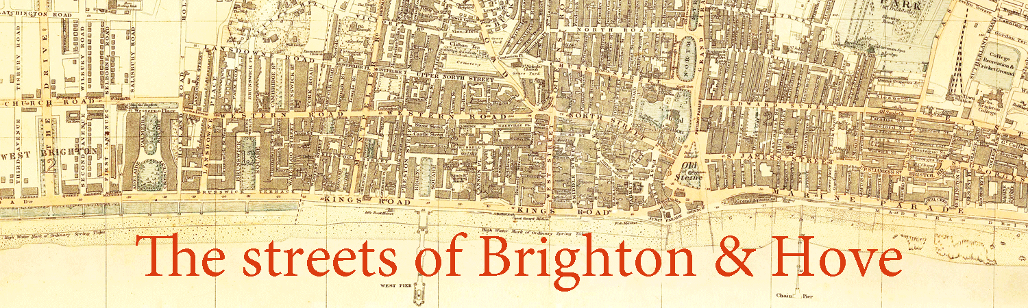
You are here: Home > Places > Streets > Streets U
Streets beginning with A B C D E F G H I J K L M N O P Q R S T U V W X Y Z | Search the site |
| U | Census districts lists | references |
| Uckfield Close, Whitehawk BN2 5 |
One of a number of streets in the area named after Sussex towns and villages. Cul-de-sac | |
| Undercliff Walk | Created as part of the sea defences that included the construction of Marine Drive, designed by borough surveyor David Edwards and opened in 1932. It is a walled ledge under the cliffs that runs from Saltdean to the Marina. It used 150,000 concrete blocks and 13,000 tons of cement and employed 500 workers. After extensive damage was repaired, it re-opened in 2006 and is now designated part of the King Charles III England Coast Path. 1  2 2 3 3 1: The Undercliff Walk under construction at Ovingdean Gap with a temporary railway track to transport materials; 2: The new Undercliff Walk under the cliff-top walk; 3: The drainage system reduces flooding on the walkway 4  4: A busy Undercliff Walk with deckchairs. |
|
| † Unicorn Yard | At 133 North Street, South end of Windsor Street. Surprisingly late appearance in street directories. |
[1826] Census1841–1891; Pa1887–Pi1910 |
| Union Road BN2 3 CA: Valley Gardens. |
North side of The Level. The gate piers to the garden of Park Crescent are Grade II listed1. The gardens have been on the B&H local list since 2015. |
Fo1864 1HE 1381037 |
| † Union Road Terrace | Census1861 | |
| Union Street BN1 1 CA: Old Town. |
North-west entrance to The Lanes, which appears to have been named part of Meeting House Lane at one time. The name is said to commemorate the Congregational Union of 1832 that united the Presbyterian, Unitarian and Independent churches but in fact was in use no later than 1822, when there were six properties in the street, including the Union Chapel. 1-5, an early 19th century terrace rebuilt in the late 20th century, are Grade II listed1. ph 6, Bath Arms, which includes 4-5 Meeting House Lane, is Grade II listed2. 9-10 are Grade II listed3. 10 was the offices of Brighton Gazette, Hove Post & Surrey & Sussex Telegraph from c1905. 11 Magnus Volk had premises here as a watch and clock maker in the 1840s. The Meeting House was built 1698 for a congregation formed in 1688 after the Act of Toleration. It was enlarged and repaired in 1810, when the premises were released in an indenture signed between Rev James Buckoll of Liddington, Gloucstershire and James Vallance and William Wigney6. It was conveyed from Vallance and others to Edward Thomas Slater and trustee in May 18247 and partly rebuilt in March-August 1825 to a design by Amon Henry Wilds (not his father as sometimes attributed) and Charles Busby, although believed to be primarily the work of the latter. The first regular minister was Rev John Duke from 1698 to 1745, during whose incumbency other denominations started to use the chapel—hence the name. It was known as Dr Styles' Chapel during his incumbency from 1799 to 18241. John Nelson Goulty became the minister in 1824. The Union Congregation took over the church in 1878, a new organ by Conacher & Son of Huddersfield was installed in March 18815, and in 1898 the church merged with the Queen Square Congregational Church as the Union Free Church. The Glynn Vivian Miners' Mission bought it in May 1905. The evangelical missionary Henry Varley preached here from 1909 until his death in 1912. In 1927 it became the Elim Tabernacle of the Church of the Four Square Gospel until it closed in 1988 and was converted into a pub. The building and its railings are Grade II listed4. ph The Font is the former Meeting House/Union Chapel. 1  2 2 1: Drawing of the Union Chapel by Amon Henry Wilds, engraved by William Alexander; 2: Union Street, north side, looking east. |
Ba1822— 1HE 1381038 2HE 1381039 3HE 1381040 4HE 1381041 5THe Building News, 25 Mar 1881:3271381041 6ESRO ACC2409/2/828 (21 Aug 1810)1381041 7ESRO ACC2409/2/830 (5 May 1825) |
| ∫ Union Street | Former name of Marine Gardens from 74 Marine Parade to 33 Upper St James's Street. | Fo1848–Pa1872 |
| † Union Street East | Census1861–1871 | |
| ∫ Union Street North | Former name of Oxford Place from 132 London Road to The Level. | Ba1822–Pa1872 |
| University of Sussex | Designed by Basil Spence and built from 1960 onwards. Falmer House and its moat are Grade I listed1. Arts A & B Buildings with the courtyard pool, The Attenborough Centre for Creative Arts (formerly Gardner Arts Centre), the Library and the Meeting House (including the kerbstones around the pool or moat) are all Grade II* listed2. Chichester Building Molecular Science I (including chemistry lecture theatre and south staircase), Engineering & Applied Sciences Building (with the adoining south staircase), and Mathematical and Physical Sciences I (including staircase to south and east to west wing attached to Pevensey Building) are all Grade II* listed3. The first men's hall of residence was designed by H Hubbard Ford in consultation with Spence4. |
1HE 1381044 2HE 1381045–1381048 3HE 1381042, 1381043, 1381049 4University of Sussex Bulletin No 5, 14 February 1963:10 |
| Uplands Road, Hollingdean BN1 7 |
Formerly part of The Crestway renumberd 5 September 19651. Numbered 5 October 1961; supplementary numbering 3 September 19741. | Ke1964 1ESRO DB/D/27/390 |
| Upper Abbey Road BN2 0 |
Continuation of Abbey Road, north of Eastern Road. Upper Abbey Road looking north |
Pi1926 |
| Upper Bedford Street BN2 1 CA: East Cliff (Fitzherbert Centre, Montague Court). |
Continuation of Bedford Street. Numbering was sequential from the south-west corner, returning down the east side; part of the street (higher numbers) were changed c1871. Originally a maze of small streets of poor quality housing on both sides. WEST SIDE (south to north) Laurel Row was here (after 7). ph †8 was St George's Tavern, which opened c1854 and was also an eating house, although a beerhouse had been here as early as 1832. It closed in 1942. —Warwick Street was here (after 9). †ph 10 was The Fountain Inn from 1854 until 1899. —Essex Cottages was here (after 11). —Here is Essex Street. —Essex Place was here (after 17). †ph 18 was The Black Prince beerhouse from 1871 to 1926. †ph 20 was listed in Le1839 as a beerhouse called Tbe Hare and Hounds. —Here is Hereford Street. Land north of here was cleared by 1947. †23. —Paradise Street was here (after 24). †ph 25 was the Star of Bedford from 1865 to 1912. —Here is Eastern Road. EAST SIDE (north to south) —Edwin Place was here. —Here is Somerset Street. †ph 32 was listed in Ta1854 as a beerhouse called the Running Horse. †ph 33, Stag Inn (previously 50) opened by 1832. Owned by Kemp Town Brewery and later by Shepherd Neame, it closed in 2012 and was demolished in 2013. Stag House, a three-storey block of nine apartments, was built 2014. ph †34 (previously 51) was The Pilot Tavern. A beerhouse called William IV was here from the late 1830s but had this name by 1864. It closed in 1916. —Bedford Buildings was here (accessed within 34). —Manchester Row was here. †36 —Crescent Cottages was here (after 37). †ph 38 (previously 55) was the Sawyers' Arms from c1843 to 1903. †39-40, Zion Chapel and Burial Ground was between 62 and 64 (old numbering) in the 1840s. It was a Bible Christian Chapel in the 1860s-1870s. ph †40, Montague Arms (previously 56) opened as the White Hart Inn by 1822 and was still here with that name in 1854 but then disappears from directories until returning as the Montague Arms in 1877. It closed c1919. —Here is Montague Street. Pelham Institute (1877-1959) replaced Zion Chapel (1829), providing cheap recreation, accommodation (1s a night or 3s 6d a week) and refreshment for working people, including lectures and concerts. It was commissioned by Archdeacon Hannah from architect Thomas Lainson. (Now Mid Sussex Judo Club and warehousing.) The building is Grade II listed1. —Here is St George's Terrace. Fitzherbert Centre was formerly St John the Baptist Roman Catholic School, being adjacent to St John the Baptist Church (see Upper St James's Street), until it took over the former Warren Farm Industrial Schools in Warren Road in 1955; a 'Girls & Infants' sign remains over the doorway. It moved to Whitehawk Hill Road in 1988. |
Br1846— 1HE 1381050 |
| Upper Bevendean Avenue, Bevendean BN2 4 |
Semi-detached houses. | Ke1934— |
| ∫ Upper Brunswick Place | Renumbered as Brunswick Place c1877. 32 (subsequently 70 Brunswick Place). was the residence of Lieut-General Sir Robert Vivian to 1870 and then of Captain (later Admiral Sir) George Granville Randolph KCB 63 (subsequently 12 Brunswick Place) was the residence of General Sir Charles Cameron Shute KCB CB MP. |
Census1841; Br1846–Pi1888 |
| Upper Chalvington Place, Whitehawk BN2 5 |
Cul-de-sac of mainly three- and four-storey blocks of council flats, with terracing and pedestrian footways leading down to Lower Chalvington Place. Chalvington is a village in West Sussex. | |
| Upper Church Street | 4 had an ice house 1834-18441. | 1R G Martin: 'Ice Houses and the Commercial Ice Trade in Brighton' in Sussex Industrial History no 14: 21 |
| Upper Cottages, Ovingdean BN2 7 |
See Ovingdean Road. | |
| Upper Drive, Hove | Cardinal Newman School is on the site of the Convent of the Sacred Heart, which was built by French nuns in 1870-72 on land belonging to the Stanford Estate that had been used as a market garden. An extension was added in 1901 to accommodate a second convent migrating from Beauvais. It has been the Carinal Newman School since 1972. It is on the B&H local list. Cottesmore St Mary School became a Catholic primary school in 1950, having been builtc1896 as a private boys prep school, designed by the London firm of A Burnet-Brann and Ernest R Barron. It is on the B&H local list. Covered reservoir is accessed between 69 and 71. 1  2 2 1,2: Sacred Heart Convent (now Cardinal Newman School) |
Pi1896 |
| † Upper Edward Street | Connected Edward Street with the Eastern Road. | Br1832–Fo1848 |
| Upper Gardner Street BN1 4AN CA: North Laine. |
Originally developed in the 1820s. A street market is held here each Saturday. Numbering is sequential from the north-east corner, and along the west side in the same direction. †ph 21 was the Foresters Arms from 1864 to 1905. It was later a secondhand bookshop (1910-1947). [ph] 34 was listed as a beerhouse called The Jolly Drayman in Le1839 only. 40 is dated 1826. It became the Brighton National School's Central Infant School in 1887 and was later the Central Boys School, then later still the Ray Tindle Centre, an arts venue. †ph 53 was listed as a beerhouse in 1846-1849. 1  2 2 3 3 4 4 1: Market in 1955; 2: Market in 1971 [Brighton & Hove Museums]; 4. The commemorative plaque on the National Schools |
Br1845— |
| ∫ Upper Gloucester Lane | Former name of Upper Gloucester Road. | |
| Upper Gloucester Road BN1 3 CA: West Hill. |
Formerly known as Surrey Place until c.1872 and Upper Gloucester Lane. Numbering continues from Gloucester Road and is sequential from the south-east end, returning along the north side. ph 67a, The Edinburgh was owned by Tamplin and opened by 1869. It was partially rebuilt in 1919 by Arthur Packham and again in 1935 by Clayton & Black. ph 70, Duke of Wellington [below] opened by 1867. It was refurbished by Stavers Tiltman in 1938. 75a was Tune's Yard in 1895, a lathrender workshop. ph †77 opened as the Bricklayer's Arms in 1843 and became the Black Lion in 1856. It was owned by Thomas Edlin in 1891-1893 and closed in 1925. 1  2 2 1: South-east end, now replaced by Princes House; 2: The Duke of Wellington PH |
To1907— |
| Upper Hamilton Road BN1 5 |
Under construction 1883. Part renumbered 15 February 18941. A tiled street name plate survives on the side of 49 Stanford Road. 10 is a former corner shop, closed before 2012 and converted to residential in 2017-2018. ph 28, The Chimney House, formerly the Marquess of Exeter, opened in 1899. It is on the B&H local list. |
Pa1883— 1ESRO DB/D/27/170 |
| Upper Hollingdean Road BN1 7 |
The continuation of Hollingdean Road north of the railway bridge, formerly known as Dog Kennel Road. Dudeney House is a 16-storey Brighton Corporation Council block of 87 flats, built by W Llewellyn in 1964-1966. Named after Councillor Walter George Dudeney, who was mayor of Brighton in 1954-55. This 15-storey block and its twin, Nettleton Court is also a 16-storey Brighton Corporation Council block of 87 flats, built by W Llewellyn in 1964-1966. Named after Councillor Herbert Nettleton, mayor of Brighton in 1970-71, acquired a reputation for poor construction and heavy maintenance requirements, fuelling arguments that the tower block era of council housing building was a big mistake. Both are built on the site of Hollingdean Depot had a railway spur from the line to Lewes that ran through the abattoir in Hollingdean Lane. Corporation 'dust destructor' (refuse incinerator) and its landmark chimney, opened in May 1886 and was used until 1952, when the waste transfer station opened in Sheepcote Valley. This building became the Hollingdean Depot's canteen. It has been on the B&H local list since 2015. †Fire station †Public abattoir 1  2 2 1: Upper Hollingdean Road; 2: Entrance to the refuse depot. |
Pi1897— |
| Upper Lewes Road BN2 3 CA: Round Hill (3, 26, 27). |
Formerly known as Gypsey Lane. Renumbered (Wakefield Terrace) 7 May 18791 and 16 August 19002. Three properties adjacent to Round Hill Crescent renumbered 20 April 18813. †1 Sylvan Lodge was the residence of Henry John Infield. The Sylvan Hall Estate (see Canterbury Drive) now stands on the site. †3 was the Brighton Free Home for Orphan Destitute Boys (1890s). ph 100, The Martha Gunn pub is named after Martha Gunn, the most famous of the Brighton 'dippers'. It was opened by Tamplin c1862 as the New Inn and acquired its current name late in the 20th century. Alfred Terrace 1851. Sylvan Lodge. 1851. |
Fo1852— 1ESRO DB/D/27/250 2ESRO DB/D/27/110 3ESRO DB/D/27/188 |
| Upper Market Street, Hove BN3 1 CA: Brunswick Town. |
The Brunswick Town market was here (see below). 2-9 were built c1830 and are Grade II listed1. [ph] 10 was the Locksmith's Arms from 1885 (but perhaps as early as 1843) until 1926. [ph] 11 was the Victory Inn from 1880 to 1908. 11A The Old Market was built in 1828 as a market for Brunswick Town but did not succeed as such. By 1840 it was a riding academy, becoming Mr Dupont's Riding Academy in 1875 or 1877 (see Waterloo Street Arch) and a warehouse and finally falling into disuse. It was restored in 1999 as a community arts centre and is Grade II listed2. |
Br1845— 1HE 1209897 2HE 1298651 |
| ∫ Upper North Lane | Former name of North Road between Queen's Road and Kew Street/North Gardens. | Census1861 |
| Upper North Street BN1 3 CA: Clifton Hill (22-57 and 63-116 consecutive, Church and Presbytery of St Mary Magdalen and school buildings adjoining, 1-5 Hampton Terrace). |
Existing as North Street Road (1832) and built mid 1840s. Numbering is sequential from the south-east corner, returning along the north side. It was renumbered from Dyke Road to the borough boundary (incorporating Montpelier Terrace and Montpelier Place) 27 August 19011. The extreme eastern end was renamed as part of Dyke Road 17 December 19522; until then North Street had extended to this junction, hence the apparently disjointed name. SOUTH SIDE east to west —Here is Dyke Road. Upper North Street Court was here (at 8). †ph 13 was listed as a beerhouse called The Tiger in Le1839 only. —Here is Regent Hill. ph 22-23, Victoria Inn (formerly 18) opened in 1839, two years after the queen's accession and strangely became the Princess Victoria in 1858. It was refurbished by Stavers Tiltman in 1927. It became The Florist c2010 and from 2012 has been the Craft Beer Co. [ph] 39 (formerly 34) opened as The Fox c1846 and was known as The Old Fox Inn from 1910. It closed in 1938. [ph] 40 (formerly 35) was listed as a beerhouse in Le1939 only. —Here is Marlborough Street. 42-43, 44, 45 are Grade II listed4. [ph] 44 (formerly 39) was the Blacksmiths Arms, which was here by 1839. Owned by Tamplin, it was refurbished by Arthur Packham in 1939 and closed in 1953. 47-48 are Grade II listed5. —Here is Dean Street. [ph] 54 (formerly 48) was the Spring Street Tavern, which opened by 1867 and closed in 1899. —Here is Spring Street. Church of St Mary Magdalene was designed by Gilbert Blount and opened in 1862. The church and neighbouring school buildings (c1865) are Grade II listed3. 55 was built c1890 as a Roman Catholic school. It became the Clergy House to Church of St Mary Magdalene (presbytery) and is now St Mary Magdalene's Community Centre. It is Grade II listed6. [ph] ph 57, The Hampton (formerly 55), also previously known as The Hampton Arms and Hampton Stores, was here by 1845. —Here is Hampton Place. —Continues as Montpelier Terrace.  Upper North Street looking west with St Mary Magdalene in the middle distance. NORTH SIDE (west to east) —Here is Montpelier Street. 58-62 are known as 1-4 Hampton Terrace. 60, then the pharmacy premises of William Funnell, was destroyed by fire on 9 September 1856. —Here is Victoria Street. 64 is Grade II listed7. —Here is Clifton Place. ph 69, Windmill Inn (formerly 63) takes its name from William Vine's mill which stood on Clifton Hill. It was here by 1982 and was refurbished by Arthur Packham in 1940. 77-89 are Grade II listed8. —Here is Dyke Road. |
Br1845— 1ESRO DB/D/27/172 2ESRO DB/D/27/309 3HE 1381058 4HE 1381051, 1381052, 1381053 5HE 1381054 6HE 1381055 7HE 1381056 7HE 1381057 |
| † Upper North Street Court | At 8 or 12 Upper North Street. Small tenements, no thoroughfare. |
Fo1850–Pa1887 |
| Upper Park Place, Queen's Park BN2 0 |
Council flats and lock-up garages. ph †24, Red Lion Inn was a Tamplins house dating from c1854. It was refurbished in 1938 by Arthur Packham. It was replaced by housing. Derby Place. |
Br1845— |
| Upper Rock Gardens BN2 1 CA: East Cliff. |
The west side was built from 1820; 27 houses by 1822 (including one occupied by John Poune, surveyor). The east side was renumbered 20 April 18811. 'Other houses building' in Pa1881-1884. Numbering is sequential, northwards on the west side, returning on the right side. †East Lodge, residence of the 3rd Earl of Egremont, was on the east side, with extensive gardens, bounded by St James's Street to the south, Edward Street to the north and St Mary's Place to the east. The site was assembled by Thomas Nevill and acquired by George O'Brien Wyndham, 3rd Earl of Egremont in 1812-1816. It was occupied in 1845 by the Earl of Jersey and his family (see Villiers) and in 1855 by the Duke and Duchess of Richmond6. It was bought by Brighton Corporation from Richard Foster in 1877 for road improvements. 3, designed by Wilds and Busby and built c1825, is Grade II listed2. 15 is Grade II listed3. 17, 18, 20, 21, 22, built c1815, are Grade II listed4. 23-26, built c1845, are Grade II listed5. 49 was St Mary's Vicarage, designed in 1880 by Spencer W Grant and built by George Lynn & Sons at a tender price of £2,8007. It is now apartments.  Tram terminus at Upper St James's Street |
Ba1822— 1ESRO DB/D/27/201 2HE 1381061 3HE 1381062 4HE 1381063–1381067 5HE 1381068 6Brighton Gazette, 28 Jun 1855:4 7The Builder, 24 Jul 1880:128 |
| Upper Roedale Cottages, Hollingbury | Two cottages off Ditchling Road, adjacent to Hollingbury golf course. They are on the B&H local list. | |
| ∫ Upper Roedale Road | Former name of Hertford Road. | |
| † Upper Russell Street | Built 1780s; 36 houses in 1822. It ran south from Western Road past Farm Yard. A continuation at right angles running west towards the north-east corner of Russell Square was built in 1810s. It was renumbered in 1872 and was lost in the Churchill Square development and no properties were listed in Ke1966. Blucher Place and Waterloo Place were off to the west. †ph 2, The Russell Arms was here from 1872 to 1895. †ph 8, The Happy Return was here from 1881 to 1893. †ph 15, The Good Intent (formerly 1-2) opened in 1839 and closed in 1926. †ph 19 (formerly 5) was listed as a beerhouse in 1845 only. †ph 29, The Fountain was here from 1839 until around the Second World War. †ph 53, The White Hart (formerly 38) was here from the 1820s until 1926. 1  2 2 3 3 1: Upper Russell Street c1940; 2: The Good Intent c1910; 3: Note Bardsley's fish and chip shop 4  4: General view prior to demolition. |
Ba1822–Ke1966 image |
| Upper St James's Street BN2 1 CA: East Cliff. |
Continuation of St James's Street, formerly called Crescent Street (c1822)3. Renumbered 4 June 18791, the numbers sequential from the north-west corner, returning along the south side. There was a town well on the corner with Grafton Street4 and public lavatories there were numbered 2 June 18922. NORTH SIDE west to east Here is Lavender Street. †1, Church Army Labour Home wasopened by Princess Louise Augusta of Schleswig-Holstein in 1907. †18, National Telephone Company exchange was here 1912. †19 was Mark Lane Mews was the stables of the Brighton, Hove and Preston United Bus Company. †ph 20 was listed as a beerhouse called The Haunch of Venison from 1839 to 18516. †ph 27, The City of Hereford was established in 1810. A Tamplins house adjacent to Upper Bedford Street, it was refurbished by Stavers Tiltman in 1927 and closed on 11 August 1971. Here is Upper Bedford Street. SOUTH SIDE east to west †ph 31 was listed as a beerhouse in 1858 only. Hampshire Court is a large three- and four-storey complex of council flats, which replaced all properties on the north side. ph 33, Hand-in-Hand opened c1862 and was owned by Kemp Town Brewery until acquired by Charringtons. It now includes a micro-brewery and is owned by Hand Brew Co. Here is Marine Gardens, formerly Union Street. Here is Charlotte Street (at 38). Here is Wyndham Street (at 42). Here is Grafton Street (at 44). †45-46 was a police station. 1  2 2 3 3 1,3: The former north side looking east [Brighton & Hove Museums]; 2: The former north side looking west [Brighton & Hove Museums]. |
[1839] Br1845— 1ESRO DB/D/27/250 2ESRO DB/D/27/226 3Wetton & Jarvis map 4ESRO DB/D/46/3 (29 Jun 1825) |
| ∫ Upper Shoreham Road, West Blatchington | See Old Shoreham Road. | Pa1891— |
| Upper Sudeley Street BN2 1 CA: East Cliff. |
Formerly known as Clevedon Place. The first houses were listed in 1883. ph 33, St George's Inn opened as the Sudeley Arms in 1869 and kept that name for up to 140 years. |
Pa1881— |
| ∫ Upper Trafalgar Street | Former name of Guildford Street until c1848, despite its 1854 listing. | Ta1854— |
| Upper Wellington Road BN2 3 |
No thoroughfare. All 26 houses were built by John Cornford, who then occupied no 2; the architect was Samuel Denman. Numbered 15 September 18801. | Pa1881— 1ESRO DB/D/27/198 |
| ∫ Upper Westbourne Villas | Former name of Westbourne Gardens north of New Church Road. | Pa1890–Pi1905 |
| Upper Winfield Avenue, Patcham BN1 8 |
Semi-detached houses, built 1930s. | Ke1934— |
| ∫ Upstreet, Ovingdean | Renamed Ovingdean Road 9 November 19331. | 1ESRO DB/D/27/19 |
Street names beginning with
A B C D E F G H I J K L M N O P Q R S T U V W X Y Z
Page updated 20 June 2026